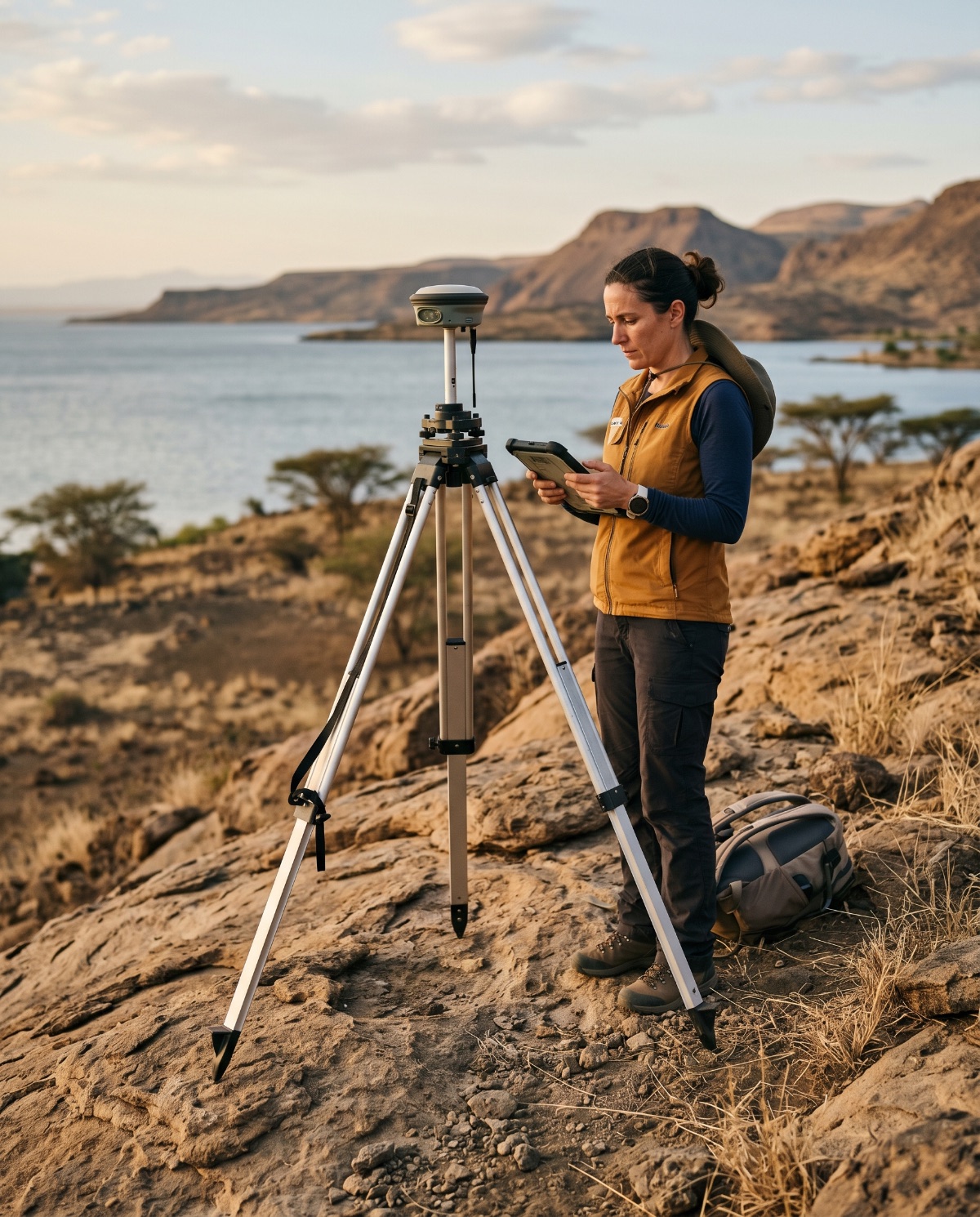
Geodesy & Survey
Precise positioning, control networks and deformation monitoring — the measured foundation every downstream decision relies on.
GWO is an independent geoscience consultancy. We measure the planet precisely, model how it is changing, and translate that evidence into policy that governments, regulators and research partners can act on.
We sit between the field and the cabinet room — turning coordinates, samples and satellite records into guidance that survives scrutiny and stands up in the places where policy is made.
Geodetic survey, remote sensing and field sampling held to documented, reproducible standards — so the baseline is never in question.
Spatial analysis of how landscapes, water bodies and climate exposure shift over time, with uncertainty stated plainly.
Findings written for the people who must decide — clear options, costed trade-offs, and a defensible evidence trail behind each one.
Precise positioning, control networks and deformation monitoring — the measured foundation every downstream decision relies on.
Spatial data infrastructure, remote-sensing analysis and mapping that make complex terrain legible to non-specialists.
Climate-change exposure, water-body and catchment studies, and impact assessment grounded in measured field evidence.
Translating findings into briefings, frameworks and stakeholder engagement that move evidence into regulation and practice.
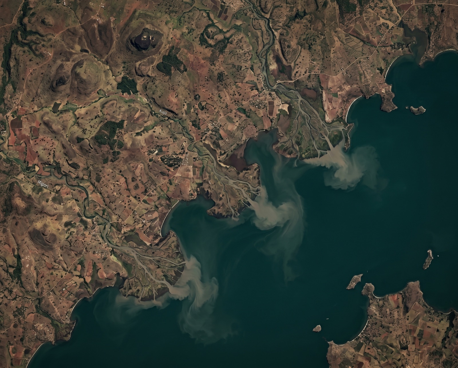
An Earth-observation-guided restoration plan for Lake Victoria, Kenya — integrating two decades of satellite, climate and geodetic records into one basin-wide recovery strategy. Random-Forest land-cover mapping reached 96.7% accuracy and revealed 26% forest loss against 75% urban growth.
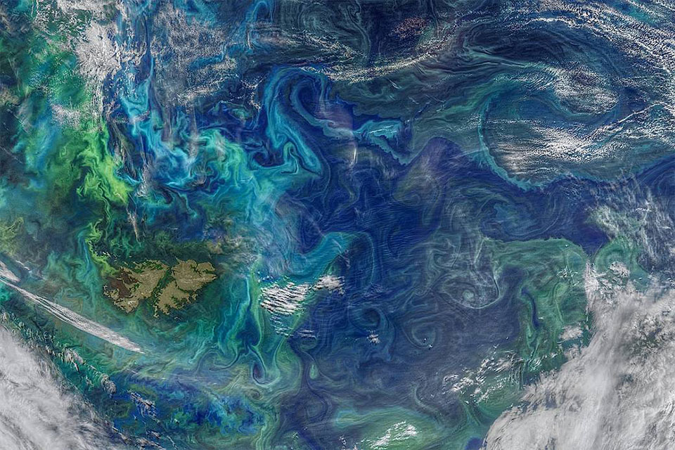
A multi-platform study fusing GNSS surface drifters, Argo floats and satellite altimetry — proving the channel moves water not as one continuous current, but as a train of migrating eddies. That structure reshapes how the region is fished, protected, navigated and cleaned up after spills.
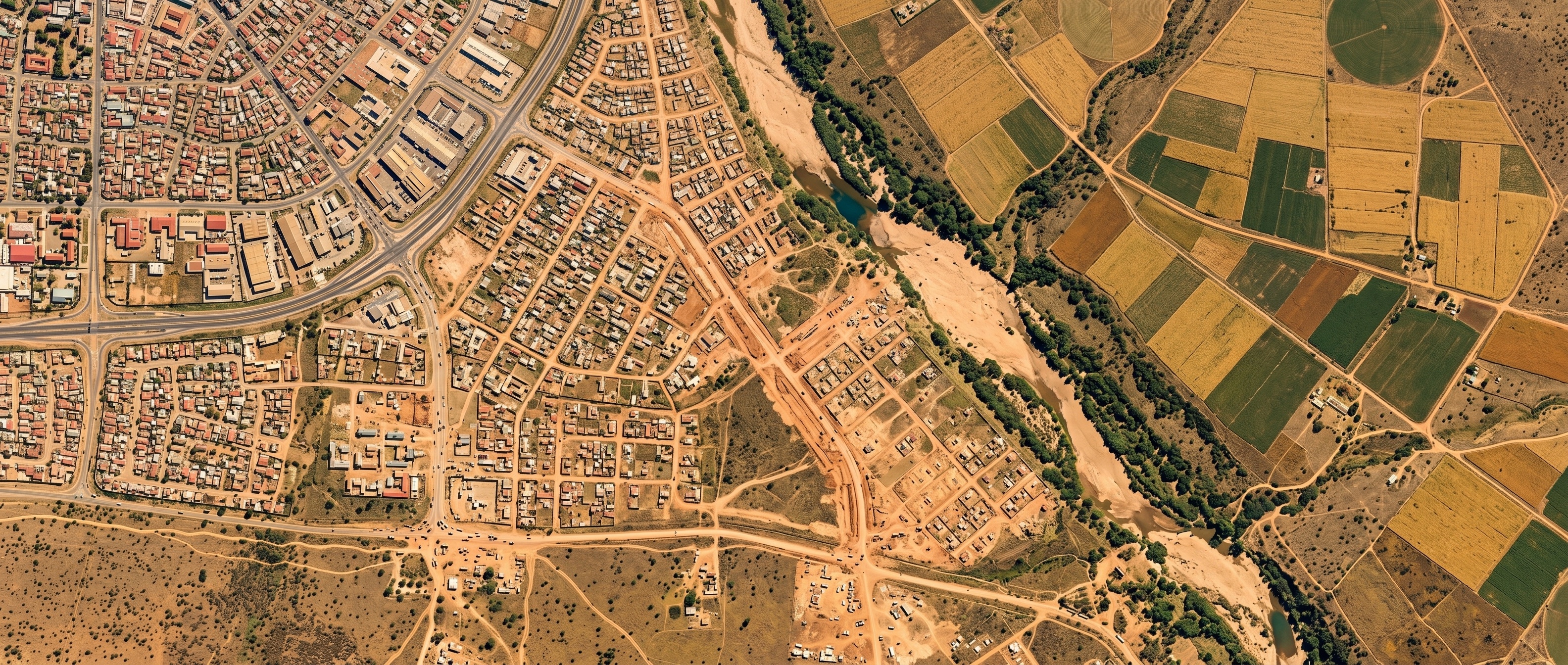
A harmonised SLEUTH-3r model run over Nairobi and Abuja — reading three decades of satellite built-up records to show how Kenya's satellite-city strategy and Nigeria's capital relocation leave opposite fingerprints in a city's growth, and where each leads by 2050.
Earlier commissions from the archive.
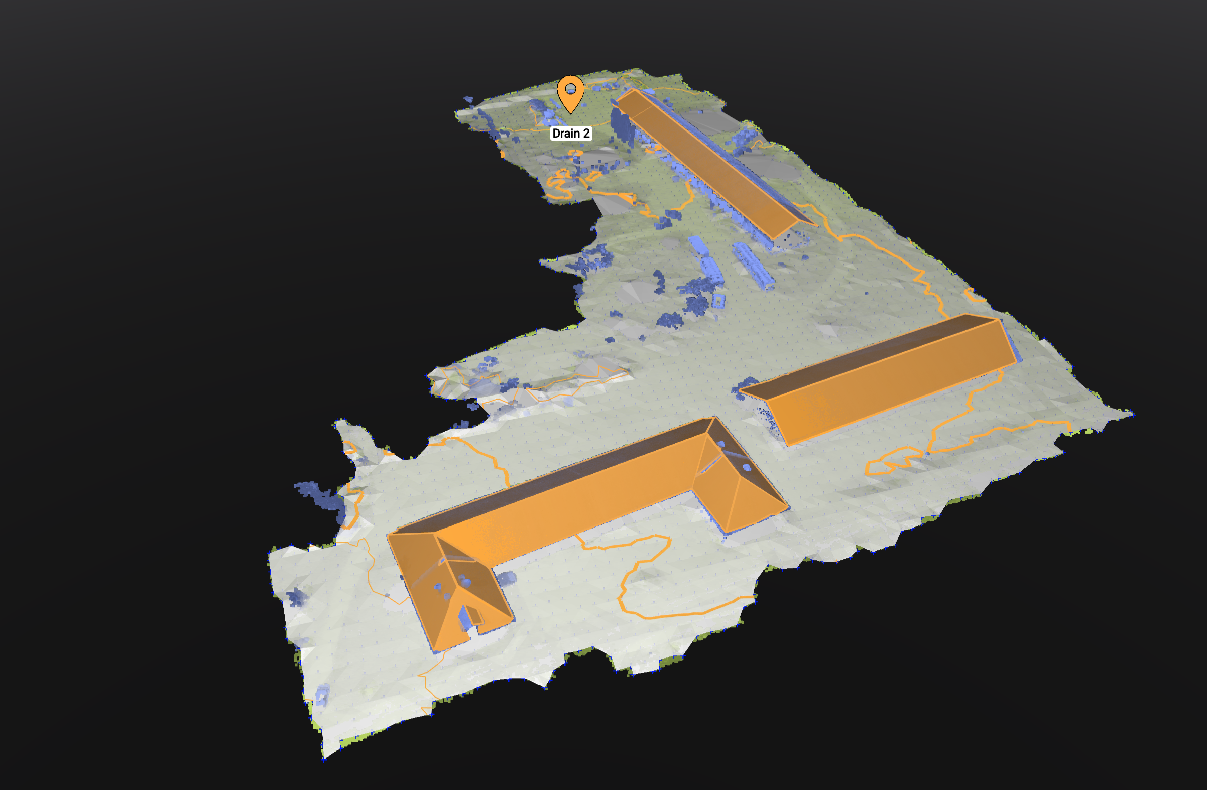
A drone-photogrammetry survey reconstructing three buildings into centimetre-scale 3D point clouds in Pix4Dmatic, then scoring each rooftop by slope, aspect and modelled irradiance to map where solar panels would pay off.
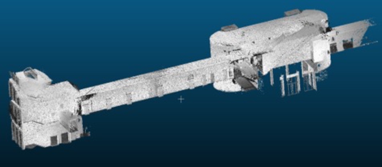
A georeferenced digital twin fusing terrestrial and mobile backpack laser scanning into one point cloud — TLS↔MLS agreement of 10–20 mm across planar surfaces. Part of the TUM2Twin initiative.
Tell us about the land, water or climate question in front of you. We reply to every serious enquiry within two working days.